Varadero
Varadero is a two-hour drive east of central Havana. It is situated on the Hicacos Peninsula, between the Bay of Cárdenas and the Straits of Florida, some 140 km east of Havana, at the eastern end of the Via Blanca highway. The peninsula is only 1.2 km wide at its widest point and is separated from the island of Cuba by the Kawama Channel, separated from the mainland by the Laguna Paso Malo. This spit of land extends more than 20 kilometers from the mainland in a northeasterly direction and its tip, Punta Hicacos, is the northernmost point of the island of Cuba. Varadero's town has three longitudinal avenues, intersected by 69 cross streets. At the northeastern end of the peninsula there is a nature reserve with virgin forests and beaches. The Hicacos Point Natural Park is a 3.12 km2 ecological preserve established in 1974. It contains the 250 m-long Cave of Ambrosio, Mangón Lake (home to 31 species of birds and 24 species of reptiles) and the ruins of the La Calavera (The Skull) Salt Works (one of the first salt works to be constructed by the Spanish in the New World). The cays developed off shore, such as Cayo Piedras and Cayo Cruz del Padre are the westernmost part of the Sabana-Camaguey Archipelago.
Juan Gualberto Gómez Airport, located 16 kilometers west of Varadero and situated west of the peninsula, is Varadero's airport. It is the second-most important airport of the island after José Martí Airport in Havana, and serves international and domestic flights. It was finished in the 1990s and replaced the old Varadero airport.
Map - Varadero
Map
Country - Cuba
 |
 |
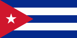
| Flag of Cuba | |
The territory that is now Cuba was inhabited by the Ciboney people from the 4th millennium BC with the Guanahatabey and Taíno peoples until Spanish colonization in the 15th century. From the 15th century, it was a colony of Spain, and slavery was abolished in 1886, remaining a Spanish colony until the Spanish–American War of 1898, when Cuba was occupied by the United States and gained independence in 1902. In 1940, Cuba implemented a new constitution, but mounting political unrest culminated in a coup in 1952 and the subsequent dictatorship of Fulgencio Batista, which was later overthrown in January 1959 by the 26th of July Movement during the Cuban Revolution, which afterwards established communist rule under the leadership of Fidel Castro. The country was a point of contention during the Cold War between the Soviet Union and the United States, and a nuclear war nearly broke out during the Cuban Missile Crisis of 1962. Following the collapse of the Soviet Union, Cuba faced a severe economic downturn in the 1990s, known as the Special Period. In 2008, Fidel Castro resigned after 49 years of leadership of Cuba and was replaced by his brother Raúl Castro.
Currency / Language
| ISO | Currency | Symbol | Significant figures |
|---|---|---|---|
| CUC | Cuban convertible peso | $ | 2 |
| CUP | Cuban peso | $ | 2 |
| ISO | Language |
|---|---|
| ES | Spanish language |


